|
Simon’s Town is situated in the north-western corner of False Bay, a huge body of water which is enclosed by the mountainous Cape Peninsular on one side and the Hottentots Holland Mountains on the other. Located just 40 kilometers (25 miles) from South Africa’s mother city of Cape Town, the town has a rich maritime tradition, a myriad of cultures, and a host of attractions, making it a much-loved day trip outing for locals, and a sought-after destination for tourists.
Simon’s Town has a long and varied history which dates back to the early days when the Dutch first occupied the Cape in 1652. It didn’t take long for the settlers to realize that False Bay offered a much safer anchorage than Table Bay, which was continually being battered by winter storms. The then Governor of the Cape, Simon van der Stel, recommended that a port be developed, and it was named Simon’s Bay in his honor. |
LSA Number |
18 |
Name |
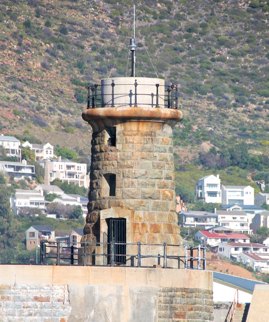
Simon's Town Dockyard |
Province |
Western Cape |
Location |
Simon's Town |
GPS Coordinates |
S34.187220 E18.440718 34°11'14.0"S 18°26'26.6"E |
ARLHS Number |
SAF-069 |
Admiralty Number |
D6144 |
NGA Number |
32300 |
Active |
Yes |
First Established |
1910 |
Commission Date |
3 November 1910 |
Decommission Date |
Not applicable |
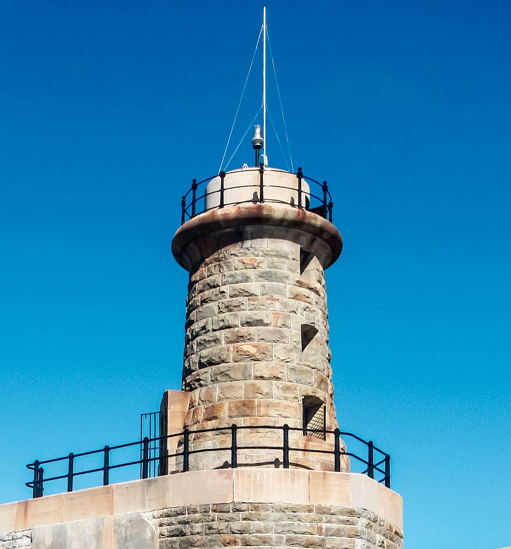
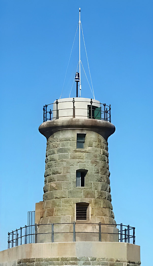
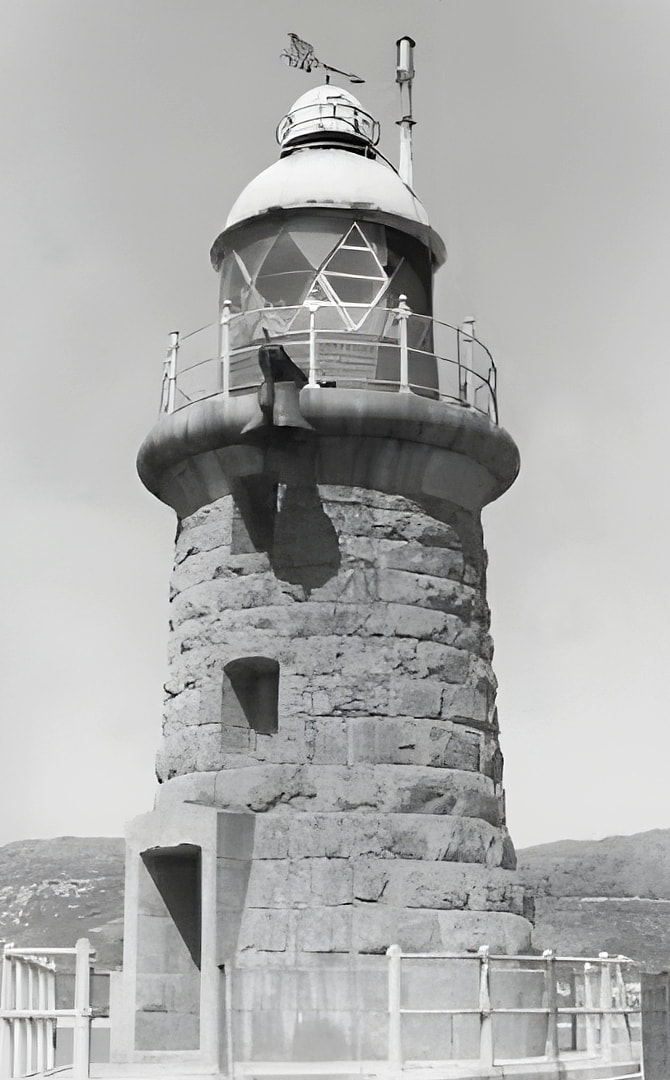
Construction Type |
Round stone tower |
Daymark |
Unpainted. |
Tower Height |
13 meters (43 feet) |
Focal Plane |
17 meters (56 feet) |
Luminous Intensity |
TBC |
Nominal Range |
11 nautical miles |
Characteristic |
Oc.W. |
Period |
4 seconds |
Pattern |
Lt. 2.5s, ec. 1.5s |
Pattern Description |
White light, 2.5 seconds on, 1.5 seconds off. |
Manned |
No |
Site Open |
No |
Fenced |
No |
Tower Open |
No |
Accommodation |
No |
Access Method |
Boat |
Access Notes |
This lighthouse is located on the east wall of the naval dockyard, and is not open to the public. It can be viewed at close range from the seaward side by boat or some other form of watercraft (kayak, sailboard, etc.) |
|
|
|

|